Company Ekoekspert” — a well-coordinated team of experienced specialists and professionals in the field of geophysical and other engineering studies. We do survey and design work, including special, on the territory of Moscow and Moscow region.
Each client we strive to offer the best solution for its specific tasks. Sometimes there are several options of work, among which one is selected — the best and rational. We have almost daily seek customers because the company “Ekoekspert” is:
- qualified personnel with appropriate permits and license to carry out works,
- more than 15 years of successful activities for conducting various surveys,
- a high level of quality of work and results on them through the use of modern equipment and traditional technologies
- accurate execution of work on time at an affordable cost,
- guarantee the harmonization and examination of final reports.
When are the geophysical surveying
“Geophysics or geophysical surveys of a certain area are mainly engaged in the composition of the geological survey or as a specialized form of research works. Before construction on the project development stage is to determine:
- geological structure allocated for development of the site,
- the physical properties and state of aggregation of soils on this site,
- the depth of groundwater,
- cracks or karst faults
- the various options that will affect the Foundation and construction of the new facility.
The specialists of “Ekoekspert” conduct geophysical surveys for purposes of construction of residential and industrial facilities. A specialized type of work — field-geophysical studies for exploration and extraction of minerals (oil, gas) — we are not fulfilled. In the design of construction project it is not recommended to refuse to conduct geophysical surveys. After all, if not will be fully studied and considered all geophysical parameters of the plot, in the process of building object may have controversial issues that will require serious financial investments. There are more serious difficulties for example, aspects of security or violations of environmental ecology.
Geophysical surveying: types of work and research
In these surveys there are 4 major processes:
— investigation of the geological structure of the area over the entire area and has several profiles to determine the composition of soils and their mechanical properties
— clarification of the nature and conditions of occurrence of rocks,
— detailed mapping of the soils of the rocky grounds,
— identification of specific types of soils,
— investigation of the geological structure of the area between the wells.
— detection and mapping of subterranean voids, cavities and their physical characteristics
— define areas of distribution of weak and fractured soils,
— definition of zones with the presence of stray currents,
— assessment of the degree of humidity of the soil and properties of corrosion activity.
— determination of the conditions and depth of aquifers,
— the identification of promising outlets for water intake and water properties,
— study and assessment of the level, speed, direction of ground water movement.
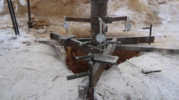
— the measurement of average borehole diameter and the angles of its curvature (caliper logging),
— determination of spatial orientation of wells and the evaluation of its status (successfully processed),
— implementation of flow measurement — definition of flow rate and fluid flow in the wellbore with the study of the hydrodynamic characteristics,
— identification of various violations in the construction of the well,
— conducting in-depth video in the well bore to determine its maintainability and evaluation of rehabilitation works (videokarta).
A specific list of surveys for the territory of each object is at the preparatory stage and fully indicated in the technical specifications.
Geophysical surveys for construction
During the geophysical survey solves important problems:
- on the choice of structures, devices, and materials for Foundation of structures based on the received information,
- depending on the condition of geological environment of the site are recommendations for the organization of protective measures against landslides, flooding,etc.
- based on observations of soils in the area of active development a forecast on the future operation of the facilities being built,
- identify the location of on-site existing underground networks and communications,
- the study is located on a dedicated stretch of concrete and reinforced concrete structures to detect cracks, deformations and other weakened zones,
- the layer definition of bulk soils in areas near roads.
For the purposes of construction geophysical surveys are conducted using methods of electromagnetic transmission, technologies of magnetic, thermal and electrical, as well as the way neglinnoy seismic. In some cases when performing complex engineering and geophysical surveys allowed to carry out complex and costly geological and hydrogeological investigations, as the information received on site is sufficient for the development of the project.
And geophysical surveys is advantageously carried out not only at the design stage, but already in the period of construction of the facility or its operation to:
- quality control of construction works, their compliance with design documentation
- track the status of the Foundation and structures of the building to determine the reasons of deformations of structures (when they appear),
- check the location of underground utilities and networks.
The benefits of performing works in Geophysics
By results of engineering-geophysical survey the client is provided with detailed and clear information about deep geological structure of the site. In this case, all work performed:
- conducted non-destructive (non-contact) research methods,
- help to obtain continuous sections of the examined soils and rocks
- reduce the drilling process
- accompanied by convenience and offer high performance.
To obtain reliable information in the course of research using modern measuring equipment and software for data processing. Thanks to this combination of technology geophysical survey areas done efficiently and carefully with the possibility of making predictions of some processes. In a constantly changing environment, professionals must work in confined spaces of dense urban development over large areas with the natural environment.
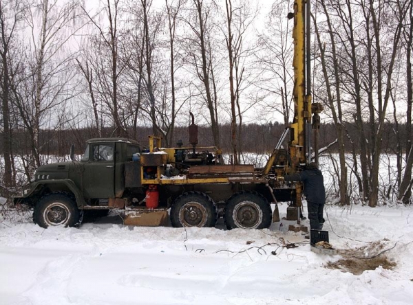
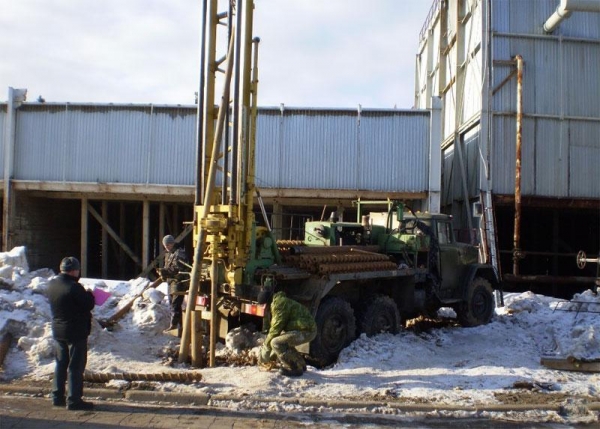
To conduct geophysical surveys and studies used specialized equipment:
- locators and metal detectors
- pedestrian magnetometers,
- electrical and GPR devices
- gradiometers and multimetre,
- the equipment for resonance-acoustic profiling.
The organization of the process of geophysical surveys
To conduct complex research with each customer is a contract specifying cost and deadlines. And then he has to provide specialists with the original documentation:
- the agreed terms of reference for the composition and methods of work
- a topographical plan or map materials in the study area (when available)
- other useful materials — research of the previous years, background information, pre-development project and others.
The careful collection and study of source materials on the object will help in proper preparation of survey programme. To further prevent the potential for duplication of results.
In addition, it is important to inform the customer that there are certain factors that prevent full implementation of geophysical exploration:
- within the allocated territory (and/or at its borders) are high folding fences, fence, an insurmountable wall, rivers, highways, ditches, trenches, gullies;
- the method of electrical prospecting — the presence on the plot of metal structures — fences, water and gas pipelines, power lines;
- the area coverage is solid asphalt, paving slabs, fine gravel or other padded material, impenetrable thickets of trees and shrubs left on the site debris in large quantities. Since the boundaries of the study area should be free movement, including for grounding the supply and receiving electrodes (pins);
- identify areas of particularly complex sections that are difficult to interpret without exploratory drilling.
Upon completion of the performed geophysical survey final technical report with detailed description of the object, used methods, obtained results. Additionally, preparing and graphics applications, plans and sections of the site indicating them reliable data and information. Fully documentation in Geophysics is transferred to the customer.
About the cost of geophysical surveys
Mostly customers prefer surveying works at an affordable price, with the use of appropriate technology and equipment. The cost of conducting geophysical surveys for each order is calculated individually, and varies depending on some conditions:
- the actual area of the land for shooting and other distinctive characteristics of the object,
- given the scale and scope of works (methods of geophysical research),
- the location of the site,
- required depth research,
- features of the study area location, climatic, geological and geomorphological.
In addition, the total cost includes the successive stages of the works:
- field studies and tests (including laboratory),
- processing of information obtained at the field stage,
- preparation of the technical report with findings and conclusions to the object.
“Ekoekspert professional level perform geophysical surveys
Our specialists are responsible implementation of geophysical surveys for areal and linear features in areas designated for residential or industrial construction. We also conduct research of a technical condition of wells used for water supply. The whole complex of works is carried out in strict compliance with applicable regulations and regulatory requirements of the legislation. The geophysical laboratory has the required analytical equipment and the necessary certificates.
Clients trust us with even the most complex orders because the company employs experienced professionals of high qualification:
- we keep to agreed contract terms conduct research,
- ready to provide free initial advice on any objects in Moscow and the Moscow region,
- assist in coordination and examination of documents to regulatory bodies.
Company Ekoekspert” — a reliable partner in conducting all types of research.
“Ekoekspert”, Moscow. Engineering studies, environmental documentation, environmental assessments.
ecosysteme.Russia